GLOSS Station Handbook – Pensacola, FL
The GLOSS Station Handbook is currently being re-designed and upgraded.
Until a new version is available, the tide gauge station list below from the last version of the Handbook provides links to further details about each tide gauge in the GLOSS Core Network. Click column headings to sort the station list table. Click the GLOSS number buttons to view the station information.
Station information
| General | |
|---|---|
| Gloss number | 288 |
| Station name | Pensacola, FL |
| Country | U.S.A. |
| Time zone | 090W, GMT - 6hrs |
| Latitude (+ve N) | 30.4 |
| Longitude (+ve E) | -87.21666 |
| Ocean | Atlantic |
| Observation periods | 1923-, being upgraded 2007 |
| Responsible country | U.S.A. |
| Authority responsible for tide gauge | NOAA, National Ocean Service, 1305 East-West Highway, Silver Spring, MD 20910-3281, USA |
| GLOSS contact | USA |
| Committed to GLOSS | Yes |
| Operational | Yes |
| Location map | |
| Instrumentation | |
| Float | Yes |
| Pressure | Yes |
| Bubbler | Yes |
| Acoustic | No |
| Radar | No |
| Data | |
| Digital data | Yes |
| Data acquisition rate | 6 minute intervals |
| Fast delivery data at UHSLC | Data 762 File format |
| High frequency data at UHSLC | Data 762a Document 762a File format |
| Data held at national organisation | Yes |
| Real-time data available | No |
| Real-time data transmitted to GLOSS Fast Centre | |
| Additional parameters (real-time) | None |
| Benchmarks | |
| Tide gauge benchmark | US C&GS tidal benchmark survey disk stamped '8 1923' set vertically in the concrete foundation wall of the City Hall Building at the corner of Jefferson and E. Zaragoza Streets. |
| Benchmark relationships | TGBM = 13.04 feet above mean lower low water (1960-1978 epoch) TGBM = 12.42 feet above mean sea level (1960-1978 epoch) TGBM = 11.81 feet above mean high water (1960-1978 epoch) TGBM is 15.694ft above tide staff zero |
| Auxiliary benchmarks | NO 1 1972 11 1923 (13.990ft above tide gauge zero) NO 2 9840 K 1977 (11.265ft above tide staff zero) 12 1923 9840 L 1978 G 9 1918 13.271 9840 M 1978 (8.708ft above tide staff zero) 9840 N 1978 (11.737ft above tide gauge zero) 9840 A 1978 |
| Data at PSMSL | |
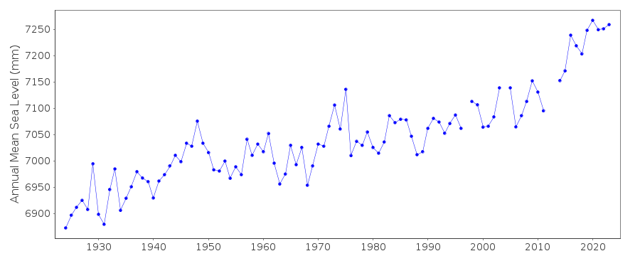
| Annual MSL (RLR) data | RLR 246 |
| Annual MSL (RLR) plot | |
| PSMSL code | 246 |
| Other relevant codes | UHSLC 762 |
| Additional information | |
| Last updated | 5 December 1993 |
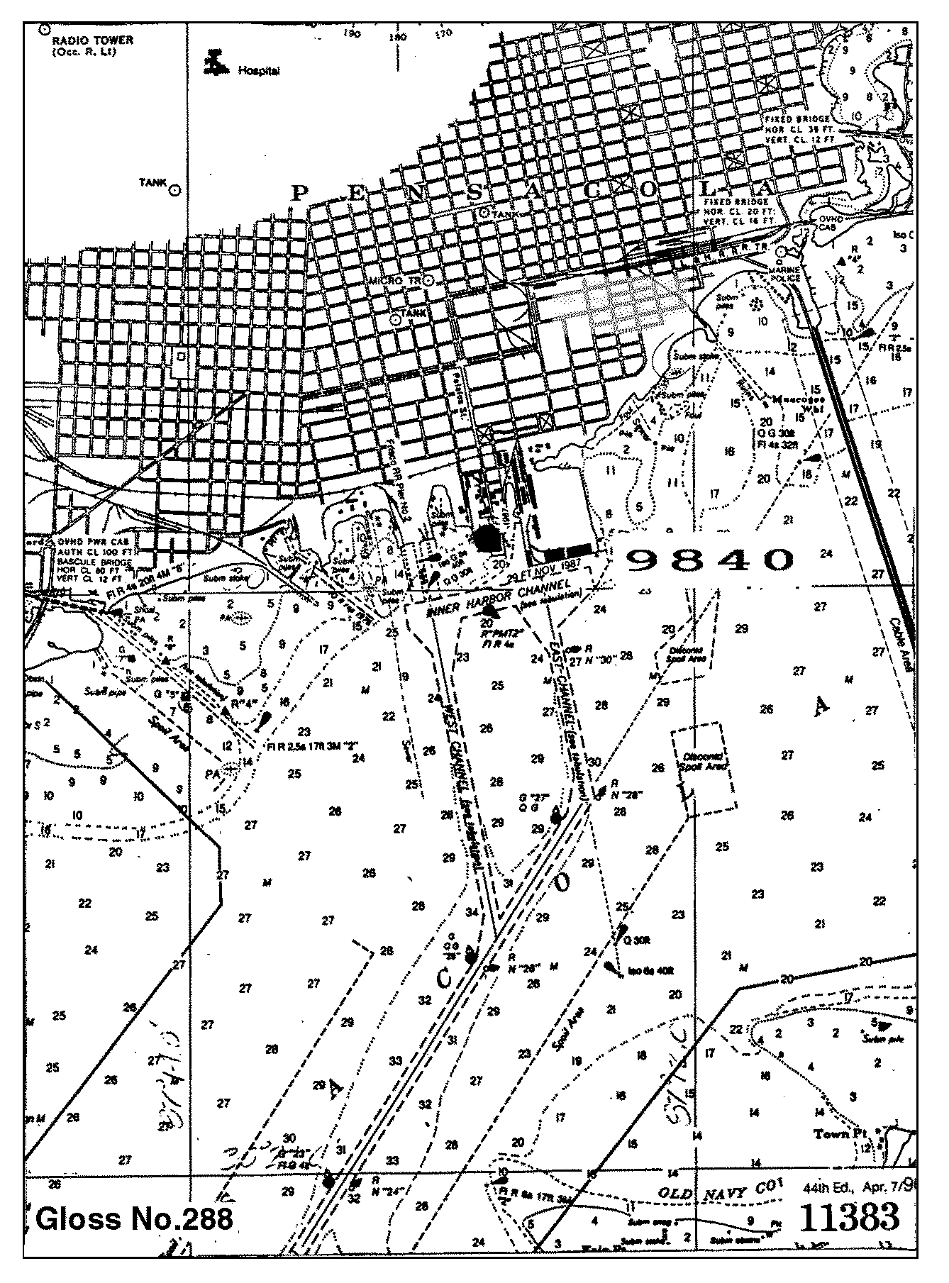
Location map
Pensacola, FL, U.S.A.
Real time data plot
Pensacola, FL, U.S.A.