GLOSS Station Handbook – Settlement Point
The GLOSS Station Handbook is currently being re-designed and upgraded.
Until a new version is available, the tide gauge station list below from the last version of the Handbook provides links to further details about each tide gauge in the GLOSS Core Network. Click column headings to sort the station list table. Click the GLOSS number buttons to view the station information.
Station information
| General | |
|---|---|
| Gloss number | 211 |
| Station name | Settlement Point |
| Country | Bahamas |
| Time zone | 075W, GMT - 5hrs |
| Latitude (+ve N) | 26.71666 |
| Longitude (+ve E) | -78.98333 |
| Ocean | Atlantic |
| Observation periods | 1985- |
| Responsible country | U.S.A. |
| Authority responsible for tide gauge | NOAA, National Ocean Service, 1305 East-West Highway, Silver Spring, MD 20910-3281, USA |
| GLOSS contact | Bahamas |
| Committed to GLOSS | Yes |
| Operational | Yes |
| Location map | |
| Instrumentation | |
| Float | Yes |
| Pressure | No |
| Bubbler | Yes |
| Acoustic | Yes |
| Radar | No |
| Data | |
| Digital data | Yes |
| Additional parameters | Wind, air temp., sea surface temp., barometric pressure |
| Data acquisition rate | Recording at 6 minute intervals; hourly heights selected from the 6 minute data. |
| Fast delivery data at UHSLC | Data 257 File format |
| High frequency data at BODC | Data 211 Document 58745 |
| High frequency data at UHSLC | Data 257a Data 257b Document 257a Document 257b File format |
| Real-time data available | Yes |
| Real-time data transmitted to GLOSS Fast Centre | |
| Additional parameters (real-time) | None |
| Benchmarks | |
| Tide gauge benchmark | 5 local benchmarks used to determine site stability |
| Benchmark relationships | Local levelling with respect to station datum. Station datum is the zero of the original staff established on 18 October 1985. |
| Data at PSMSL | |
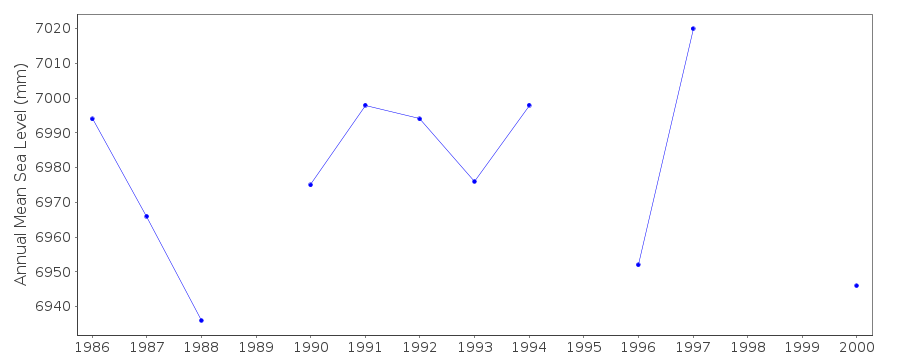
| Annual MSL (RLR) data | RLR 1646 |
| Annual MSL (RLR) plot | |
| MSL method | Arithmetic mean of hourly hts |
| PSMSL code | 1646 |
| Other relevant codes | UHSLC 257 |
| Additional information | |
| Other relevant information | Two tide gauges here, A and B. Both have GPS |
| Nearest Met. station | Settlement Point (co-located) |
| Last updated | 5 December 1993 |
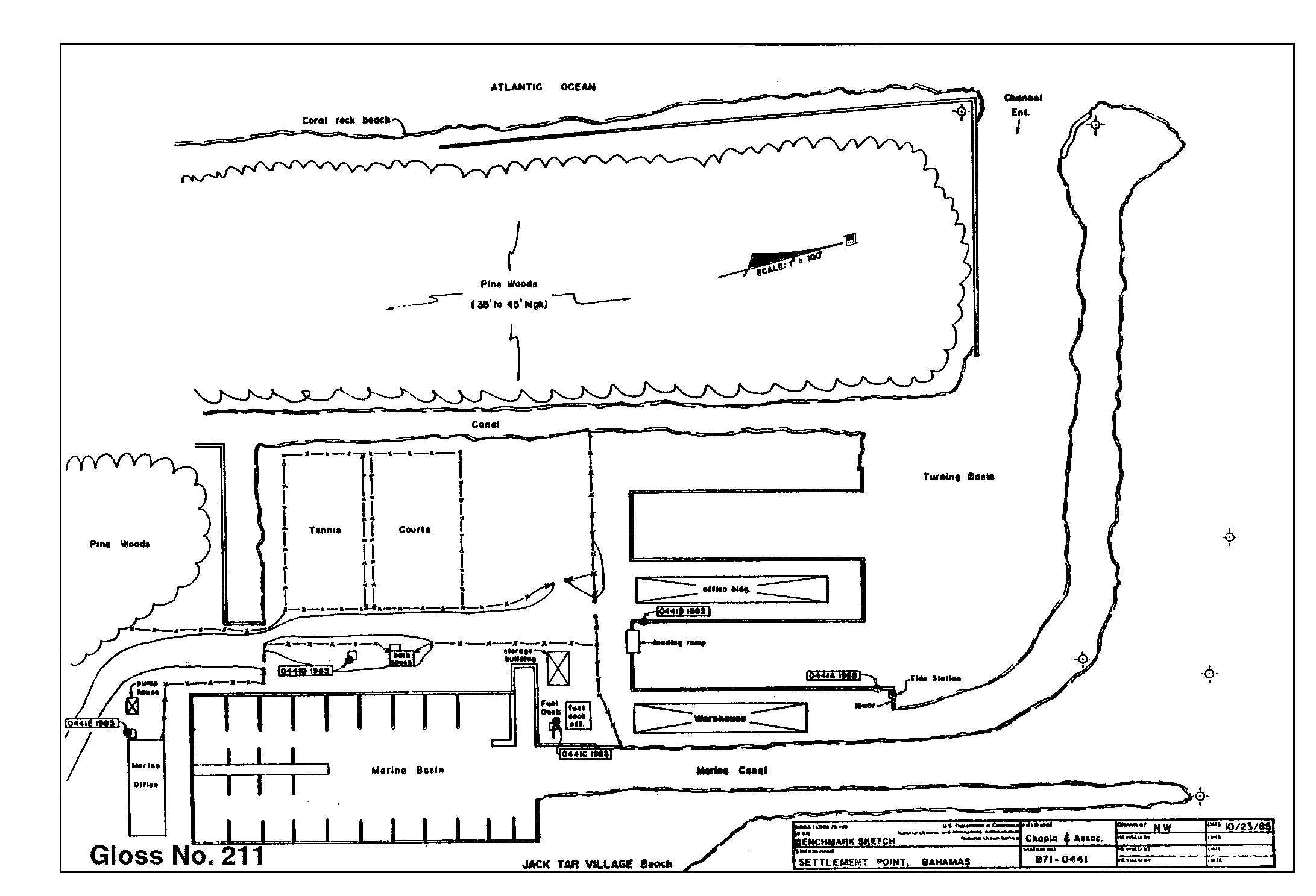
Location map
Settlement Point, Bahamas
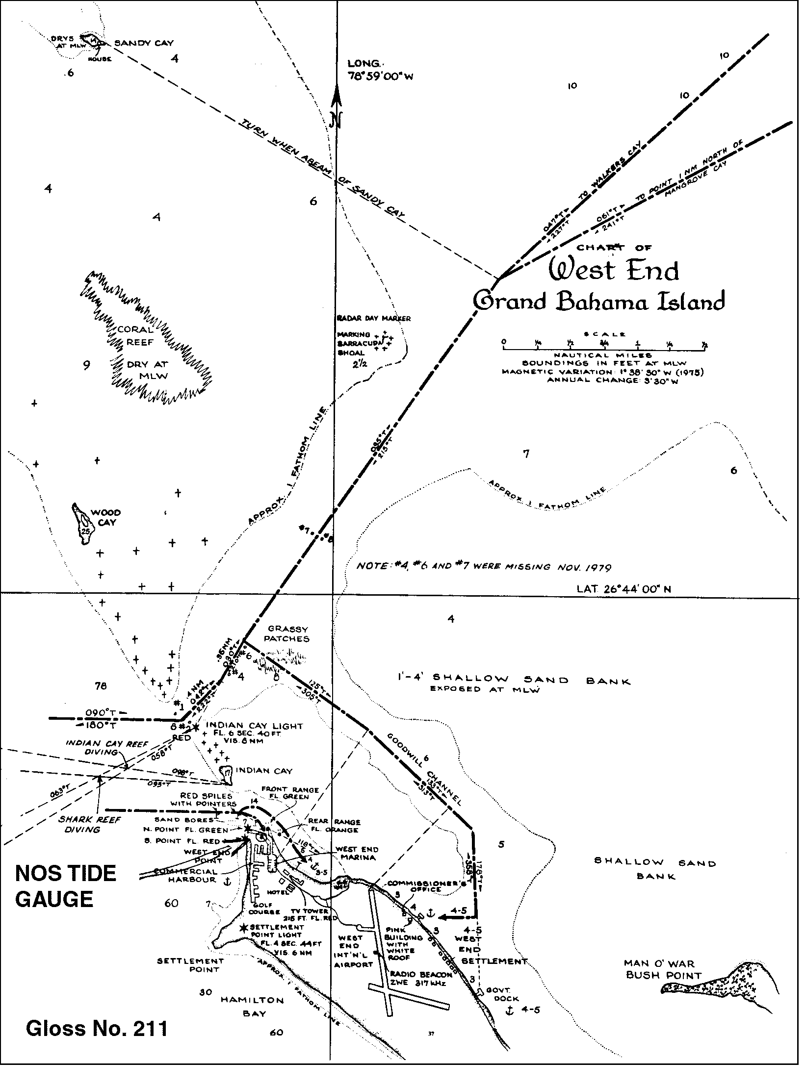
Location map
Settlement Point, Bahamas
Real time data plot
Settlement Point, Bahamas