GLOSS Station Handbook – Fernando de Noronha
The GLOSS Station Handbook is currently being re-designed and upgraded.
Until a new version is available, the tide gauge station list below from the last version of the Handbook provides links to further details about each tide gauge in the GLOSS Core Network. Click column headings to sort the station list table. Click the GLOSS number buttons to view the station information.
Station information
| General | |
|---|---|
| Gloss number | 198 |
| Station name | Fernando de Noronha |
| Country | Brazil |
| Latitude (+ve N) | -3.83333 |
| Longitude (+ve E) | -32.4 |
| Ocean | Atlantic |
| Observation periods | ORSTOM for 1982-1983, 1984-1985, 1972-1985, 1991-, Kalesto gauge due 2008 |
| Responsible country | Brazil |
| Authority responsible for tide gauge | Directoria de Hidrografia e Navegacao, Divisao de Servicos Oceanicos, Rua Bar?o de Jaceguay, s/n? Ponta da Armac?o ? Niteroi (for 1972 data only) |
| GLOSS contact | Brazil |
| Committed to GLOSS | Yes |
| Operational | Yes |
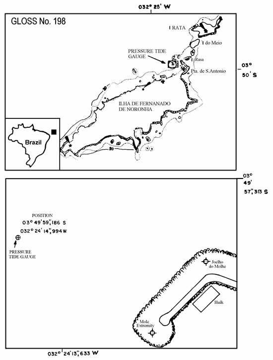
| Location map | |
| Instrumentation | |
| Float | No |
| Pressure | Yes |
| Bubbler | No |
| Acoustic | No |
| Radar | No |
| Data | |
| Digital data | Yes |
| High frequency data at UHSLC | Data 203a Data 203b Data 203c Document 203a Document 203b Document 203c File format |
| Real-time data available | Yes |
| Additional parameters (real-time) | None |
| Data at PSMSL | |
| Annual MSL (RLR) data | Yes (Monthly metric data only available) |
| PSMSL code | 1829 |
| Other relevant codes | UHSLC 203 |
| Additional information | |
| Other relevant information | Data transmitting by satellite ARGOS platform will be installed in December 1992. World heritage site http://whc.unesco.org/en/list/1000 |
| Nearest Met. station | WMO No. 82595 - Calcanhar |
| Last updated | 26 September 1992 |
Location map
Fernando de Noronha, Brazil