GLOSS Station Handbook – Prudhoe Bay, AK
The GLOSS Station Handbook is currently being re-designed and upgraded.
Until a new version is available, the tide gauge station list below from the last version of the Handbook provides links to further details about each tide gauge in the GLOSS Core Network. Click column headings to sort the station list table. Click the GLOSS number buttons to view the station information.
Station information
| General | |
|---|---|
| Gloss number | 151 |
| Station name | Prudhoe Bay, AK |
| Country | U.S.A. |
| Time zone | 135W, GMT - 9hrs |
| Latitude (+ve N) | 70.4 |
| Longitude (+ve E) | -148.52666 |
| Ocean | Arctic |
| Observation periods | 1976 - 1989, summer season only 27 Jun 1993 - 31 Jul 2003 |
| Responsible country | U.S.A. |
| Authority responsible for tide gauge | N/OES22 SSMC4, STATION 7109 1305 East West Highway Silver Spring, MD. 20910-3233 |
| GLOSS contact | USA |
| Committed to GLOSS | Yes |
| Operational | Yes |
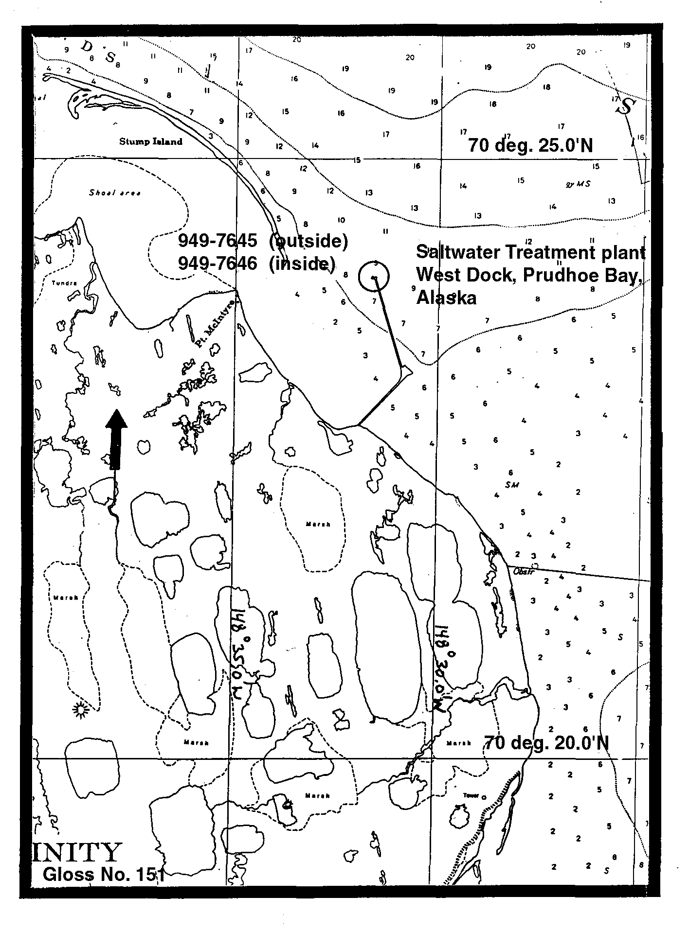
| Location map | |
| Instrumentation | |
| Float | No |
| Pressure | No |
| Bubbler | Yes |
| Acoustic | Yes |
| Radar | No |
| Data | |
| Digital data | Yes |
| Additional parameters | Air/sea temperature, barometric pressure, wind sensors |
| Data acquisition rate | 6 minute intervals |
| Fast delivery data at UHSLC | Data 579 File format |
| High frequency data at BODC | Data 151 Document 62927 |
| High frequency data at UHSLC | Data 579a Document 579a File format |
| Data held at national organisation | Yes |
| Real-time data available | Yes |
| Real-time data transmitted to GLOSS Fast Centre | |
| Additional parameters (real-time) | None |
| Benchmarks | |
| Tide gauge benchmark | The benchmark is the high point on top of the sheet pile bulkhead where two pieces seam together on West Dock #2. Benchmark is designated 'unstamped 2'. |
| Benchmark relationships | TGBM = 7.68 feet above mean lower low water (154 HW/155 LW 1980-1981) TGBM = 7.33 feet above mean sea level (154 HW/155 LW 1980-1981) TGBM = 7.08 feet above mean high water (154 HW/155 LW 1980-1981) |
| Auxiliary benchmarks | Movement seen between 'steel pin' and 'state 1' and cell 6B and digibulb stop. BM Bridge installed 1993. |
| Data at PSMSL | |
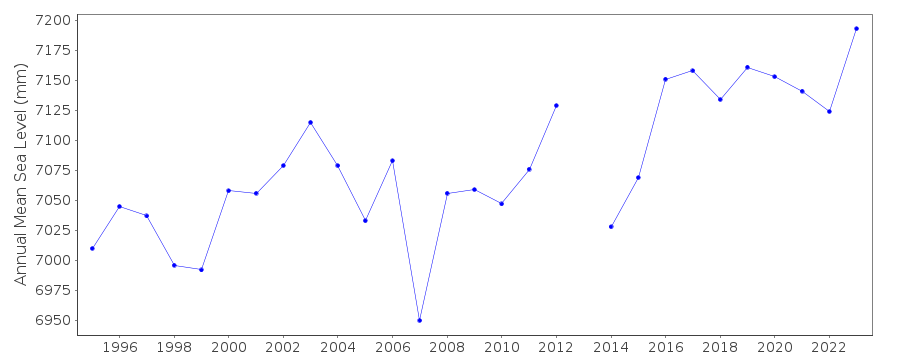
| Annual MSL (RLR) data | RLR 1857 |
| Annual MSL (RLR) plot | |
| PSMSL code | 1857 |
| Other relevant codes | UHSLC 579A |
| Additional information | |
| Other relevant information | Using acoustic in the ice free season and a bubbler gauge when there is ice while the gauge is rebuilt. 1976-1989 data collected during ice-free months only (usually July, August and September) |
| Last updated | 16 February 2005 |
Location map
Prudhoe Bay, AK, U.S.A.
Real time data plot
Prudhoe Bay, AK, U.S.A.