GLOSS Station Handbook – Suva
The GLOSS Station Handbook is currently being re-designed and upgraded.
Until a new version is available, the tide gauge station list below from the last version of the Handbook provides links to further details about each tide gauge in the GLOSS Core Network. Click column headings to sort the station list table. Click the GLOSS number buttons to view the station information.
Station information
| General | |
|---|---|
| Gloss number | 122 |
| Station name | Suva |
| Country | Fiji |
| Time zone | 180E, GMT + 12hrs |
| Latitude (+ve N) | -18.13333 |
| Longitude (+ve E) | 178.43333 |
| Ocean | Pacific |
| Observation periods | 1975-1988 Float/stilling well 1989- Acoustic added |
| Responsible country | Australia |
| Authority responsible for tide gauge | National Tidal Centre, Australia (see GLOSS Contact Points). |
| GLOSS contact | Australia |
| Committed to GLOSS | Yes |
| Operational | Yes |
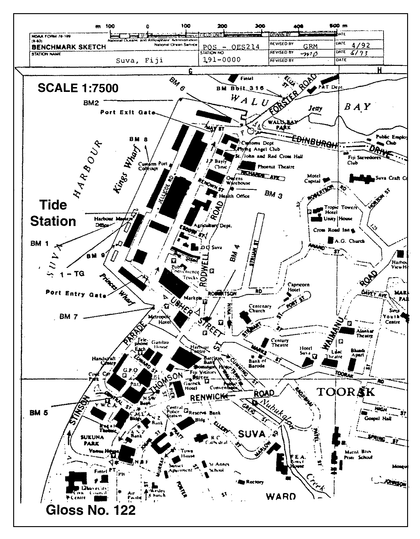
| Location map | |
| Instrumentation | |
| Float | Yes |
| Pressure | No |
| Bubbler | No |
| Acoustic | Yes |
| Radar | No |
| Data | |
| Digital data | Yes |
| Additional parameters | Barometric pressure, wind speed & direction, air & water temperature |
| Data acquisition rate | Recorded at 6 minute intervals |
| Fast delivery data at UHSLC | Data 018 File format |
| High frequency data at BODC | Data 122 Document 77230 Document 57284 |
| High frequency data at UHSLC | Data 018a Data 018b Document 018a Document 018b File format |
| Real-time data available | Yes |
| Additional parameters (real-time) | None |
| Benchmarks | |
| Tide gauge benchmark | NOS benchmark disk stamped '1 1989' set in concrete sea wall of the dockat Kings Wharf near the Ports Authority Office Building. |
| Benchmark relationships | TGBM = 8.89 feet above mean lower low water (1960-1978 epoch) TGBM = 6.64 feet above mean sea level (1960-1978 epoch) TGBM = 4.71 feet above mean high water (1960-1978 epoch) |
| Auxiliary benchmarks | 2 1989 Screw 6 unstamped 3 1989 Screw 7 unstamped 4 1989 Screw 8 unstamped 5 1989 1-TG unstamped: brass screw inset in triangle 2ft S of tide house and 1.5 ft from edge of wharf |
| Data at PSMSL | |
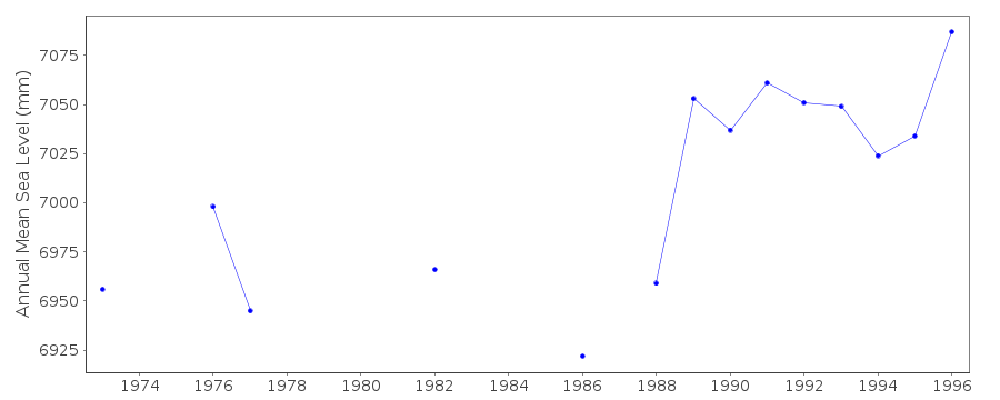
| Annual MSL (RLR) data | RLR 1327 |
| Annual MSL (RLR) plot | |
| MSL method | Hourly means |
| PSMSL code | 1327 |
| Other relevant codes | NTF port no. 67050, UHSLC 018 |
| Additional information | |
| Other relevant information | A gauge was maintained on behalf of the TOGA Sea Level Center until it was withdrawn in May 1989 (PSMSL Code 742/013 1975-1989). A gauge at Kings Wharf was destroyed in Nov 1983 and the station was relocated to Walu Bay Naval Facility (operated by Univ. Hawaii). There was an overlap of 3 months with the new NOAA gauge and the Walu gauge. PSMSL also hold data from another gauge (PSMSL Code 742/011 1960-1961,1964). NTF took over the gauge from NOAA in November 1997. |
| Nearest Met. station | Laucala Bay, Suva |
| Last updated | 16 October 2002 |
Location map
Suva, Fiji
Real time data plot
Suva, Fiji