GLOSS Station Handbook – Kwajalein
The GLOSS Station Handbook is currently being re-designed and upgraded.
Until a new version is available, the tide gauge station list below from the last version of the Handbook provides links to further details about each tide gauge in the GLOSS Core Network. Click column headings to sort the station list table. Click the GLOSS number buttons to view the station information.
Station information
| General | |
|---|---|
| Gloss number | 111 |
| Station name | Kwajalein |
| Country | Marshall Is. |
| Time zone | 180E, GMT + 12hrs |
| Latitude (+ve N) | 8.73333 |
| Longitude (+ve E) | 167.73333 |
| Ocean | Pacific |
| Observation periods | 1946-, due for upgrade 2007 |
| Responsible country | U.S.A. |
| Authority responsible for tide gauge | NOAA, National Ocean Service, 1305 East-West Highway, Silver Spring, MD 20910-3281, USA |
| GLOSS contact | USA |
| Committed to GLOSS | Yes |
| Operational | Yes |
| Location map | |
| Instrumentation | |
| Float | Yes |
| Pressure | No |
| Bubbler | Yes |
| Acoustic | Yes |
| Radar | No |
| Data | |
| Digital data | Yes |
| Additional parameters | Air/sea surface temp, density pressure, wind speed/ direction |
| Data acquisition rate | Digital gauge: 6 minute interval (after 1976) Analog gauge: hourly heights (before 1976) |
| Fast delivery data at UHSLC | Data 055 File format |
| High frequency data at BODC | Data 111 Document 57440 |
| High frequency data at UHSLC | Data 055a Document 055a File format |
| Data held at national organisation | Yes |
| Real-time data available | Yes |
| Real-time data transmitted to GLOSS Fast Centre | |
| Additional parameters (real-time) | None |
| Benchmarks | |
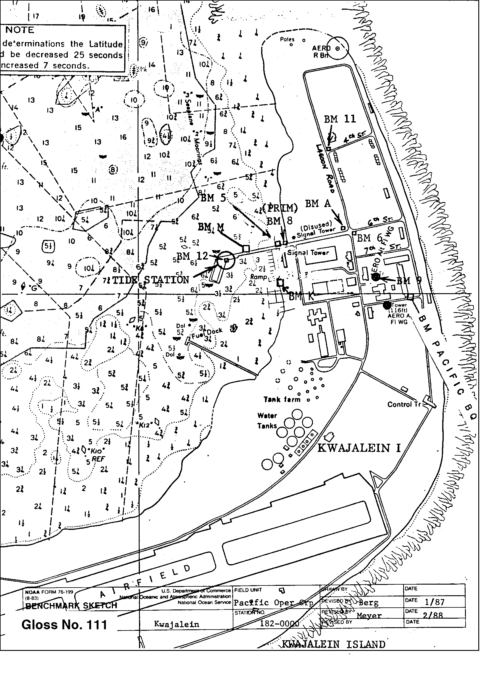
| Tide gauge benchmark | Benchmark 8 (1957) is the primary benchmark (PBM) set in the north side of the former sea wall of Echo Pier. |
| Benchmark relationships | TGBM is 9.36ft above Tide Gauge Zero (Station Datum) NOAA Chart Datum (MLLW) is 2.83ft above Station Datum Mean Sea Level (1960-1978) is 4.73ft above Station Datum |
| Data at PSMSL | |
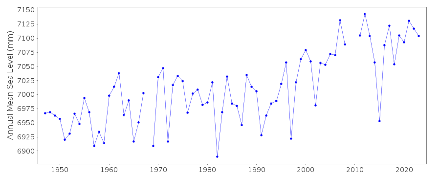
| Annual MSL (RLR) data | RLR 513 |
| Annual MSL (RLR) plot | |
| PSMSL code | 513 |
| Other relevant codes | UHSLC 055 |
| Additional information | |
| Last updated | 5 December 1993 |
Location map
Kwajalein, Marshall Is.
Real time data plot
Kwajalein, Marshall Is.