GLOSS Station Handbook – French Frigate Shoals, H
The GLOSS Station Handbook is currently being re-designed and upgraded.
Until a new version is available, the tide gauge station list below from the last version of the Handbook provides links to further details about each tide gauge in the GLOSS Core Network. Click column headings to sort the station list table. Click the GLOSS number buttons to view the station information.
Station information
| General | |
|---|---|
| Gloss number | 107 |
| Station name | French Frigate Shoals, H |
| Country | U.S.A. |
| Time zone | 165W, GMT - 11hrs |
| Latitude (+ve N) | 23.86666 |
| Longitude (+ve E) | -166.28333 |
| Ocean | Pacific |
| Observation periods | 1975-, being upgraded 2007 |
| Responsible country | U.S.A. |
| Authority responsible for tide gauge | Dr. M. Merrifield, University of Hawaii, Dept. of Oceanography, 1000 Pope Road MSB 307, Honolulu, Hawaii 96822, U.S.A. |
| GLOSS contact | USA |
| Committed to GLOSS | Yes |
| Operational | Yes |
| Location map | |
| Instrumentation | |
| Float | Yes |
| Pressure | Yes |
| Bubbler | No |
| Acoustic | No |
| Radar | No |
| Data | |
| Digital data | Yes |
| Data acquisition rate | 15 minute intervals, filtered to hourly heights |
| Fast delivery data at UHSLC | Data 014 File format |
| High frequency data at BODC | Data 107 Document 59852 |
| High frequency data at UHSLC | Data 014a Document 014a File format |
| Real-time data available | Yes |
| Real-time data transmitted to GLOSS Fast Centre | |
| Additional parameters (real-time) | None |
| Benchmarks | |
| Auxiliary benchmarks | UH2 SS bolt head, set in concrete, at entrance of tide house. UH3 SS bolt set in concrete, stamped 'KAMBIC/ JONES' on sea wall 2ft west of tide well. UH4 SS bolt head set in concrete, stamped '4', located at the north west corner of the Weather Service tower. UH5 SS bolt head set in concrete, NW corner steps of Main building. |
| Data at PSMSL | |
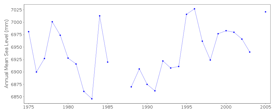
| Annual MSL (RLR) data | RLR 1372 |
| Annual MSL (RLR) plot | |
| MSL method | average of daily values |
| PSMSL code | 1372 |
| Other relevant codes | UHSLC 014 |
| Additional information | |
| Other relevant information | Other benchmark: UH6 SS bolt head set in concrete, no stamp, located at the NE corner of the Main building foundation pillar. Daily values calculated using 119-point convolution filter (Bloomfield, 1976) centred on noon applied to the hourly data with respective periods of the 95, 50 and 5% amplitude points at 124.0, 60.2 and 40.2 hours. |
| Nearest Met. station | Buoy 51001, ~400 miles ESE |
| Last updated | 5 December 1993 |
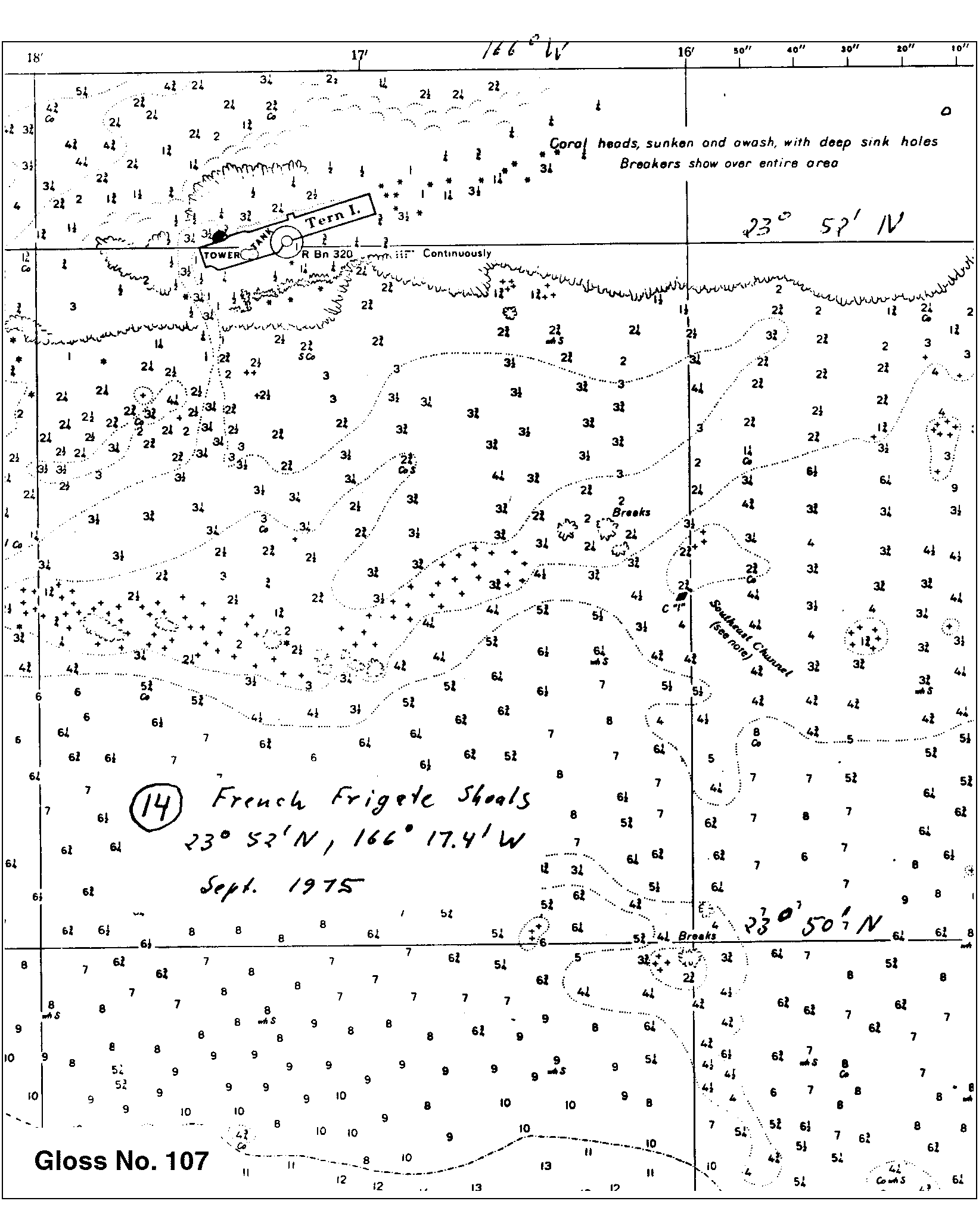
Location map
French Frigate Shoals, H, U.S.A.
Real time data plot
French Frigate Shoals, H, U.S.A.